Earth LinC · NAVI 2.0 · Sentinel-2 L2A · Reading Session
An Earth scientist's annotated dialogue with a living planet
JUL 18 · 2026 · ONE // For SEE
Field Notes · Opening Statement
"Every pixel is a sentence. The planet has always been writing — we are only now learning to read it."
This station is a single sitting with Sentinel-2 imagery sourced through Microsoft Planetary Computer. It is not a map gallery. It is a reading — structured the way a field scientist reads a landscape: pattern first, process second, meaning last.
NAVI navigates these scenes as an Earth-literate companion, placing marks where the data speaks and pausing where wonder is the most honest response. The squares, points, and lines drawn here are not decorations — they are the pointing fingers of attention.
Follow them. Then look past them at what they almost touch.
Read 01 · Orbital Panorama
READ 01 / 16
At orbital scale, color is information. The deep blue-black of open ocean absorbs rather than reflects. Green onshore is photosynthesis made visible — chlorophyll translated into pixel. White is water, arrested in the act of rising. Sentinel-2's natural-color band combination (B04·B03·B02) renders what the human eye would see from a window in the sky — but this is not a photograph; it is a measurement translated into light.
The annotated square identifies a convective cloud mass — warm moist air ascending, cooling, condensing. The point marks the land–sea interface, the most ecologically productive seam on Earth. The dashed line traces a coastal gradient that is, in a very real sense, a climate boundary.
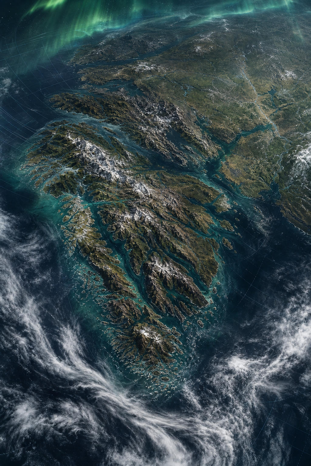
"The satellite does not choose what to show. It measures everything. We are the ones who choose what to see — and that choice is already an act of science."
— NAVI 2.0 · Earth LinC Reading Session
Reads 02–03 · Surface Contrast
READ 02
Coastlines are not lines — they are negotiations between water and land, recorded in sediment and expressed in fractal curves. The amber point marks a river mouth: the site where freshwater carrying continental memory meets salt water. The square isolates a peninsula — land almost claimed by sea, a form that appears at every scale from a continent to a mudflat.
READ 03
Humans write on Earth too. The rectangular field mosaic is an agricultural signature — bounded by ownership, irrigation, and crop rotation. Each green-tinted square is a different phenological moment: one field freshly planted, another mid-canopy, a third harvested. The line connecting two settlement points follows a logic of roads and water access that has nothing to do with ecology and everything to do with history.
Reads 05–07 · Texture and Process
READ 05
Vegetation reflectance in the red band drops where chlorophyll absorbs. The bright warm-square zone shows dense, active canopy. The point marks a stress boundary — possibly fire scar, drought edge, or pest pressure. A forest is a sentence that changes every season.
READ 06
Where vegetation disappears, lithology speaks directly. The amber box captures a bare-surface zone — high shortwave reflectance, low near-infrared. The amber line traces a structural lineament: a fault, an old stream, or a road. Arid landscapes are legible in ways dense vegetation obscures.
READ 07
Urban surfaces — concrete, asphalt, metal rooftops — return a characteristic reflectance signature: bright across multiple bands, hot in thermal infrared, fragmented by roads. The coral square identifies a dense urban core. Two points locate a park (lower reflectance) and an industrial zone (high shortwave). Every city has a spectral fingerprint.
"NDVI, NDWI, EVI — these are not acronyms. They are sentences in the planet's vocabulary, translated by arithmetic from raw light into meaning."
— ONE // For SEE · Earth LinC
Reads 08–09 · Water Systems
READ 08
A river delta is a signature written in sediment. The blue dashed arc traces the dominant flow path — visible as turbid water against the dark ocean. The large square encompasses the distributary zone where one channel becomes many: a fan of possibility, each arm rerouting sediment and ecosystem. The point marks maximum turbidity — the river still carrying its continent's news to the sea.
READ 09
Lakes and reservoirs are memory — they integrate years of precipitation, evaporation, and human withdrawal. The green-outlined box frames the open water surface. Two points mark the inflow zone (amber: higher turbidity, warmer tone) and the main body (green: deeper, colder, clearer). Even at 10-metre resolution, stratification leaves a visible surface trace.
Reads 11–13 · Change Signatures
READ 11
A burn scar or deforestation footprint appears in Sentinel-2 as a stark shift from NIR-bright vegetation to shortwave-bright bare soil. The coral square marks a recently disturbed zone — fresh enough that the soil is still exposed before secondary growth begins to re-green. The point locates maximum disturbance intensity. This is Earth writing in a language called loss.
READ 12
A phenological boundary is where spring ends and summer stalls, or where the monsoon stops. The amber box captures a transition zone — one side photosynthetically active, the other dormant. The line below it traces the ecotone: a gradient disguised as an edge. These boundaries shift year by year and are among the most sensitive indicators of climate change.
READ 13
Remote sensing conventions treat cloud as a masking problem. But cloud morphology encodes atmospheric dynamics: convective towers indicate instability, stratiform sheets indicate subsidence. The large box frames the cloud layer. One point marks a convective tower top (bright, high); the warm point marks a cloud-free surface window below — the Earth briefly legible through a gap.
Read 14 · The Close Read
READ 14 / 16
This scene demands all three annotation types simultaneously. The warm square marks active growth — high NIR reflectance, dense canopy cover, photosynthetically at peak. The blue square below identifies a zone of secondary succession: pioneer plants re-establishing on disturbed ground, a story of recovery told in lower-density green. The amber point is a stress marker — where moisture stress or pest pressure has begun reducing chlorophyll. The coral point identifies a feature in the lowest portion: possibly bare soil, possibly exposed rock — the substrate speaking through the vegetation.
The two dashed lines connect the stress point to the active zone, and the recovery zone to the disturbed ground. Together they read: this landscape was disturbed, is recovering, but is not yet free of pressure. That is what 10 metres of resolution, four spectral bands, and a careful eye can decode from a single frame.
Reads 15–16 · Coda — Light and the Observer
READ 15
The penultimate scene is the integrator: a frame where multiple surface types — water, vegetation, soil, cloud — appear together. A single Sentinel-2 image tile covers 110 × 110 kilometres. At that scale, the ecological, geomorphic, and atmospheric stories converge into one frame. The point at center is the focal point of the entire reading: the place where all the systems the planet runs simultaneously — water cycle, carbon cycle, heat exchange — overlap for an instant and a measurement is made.
READ 16
The final frame is not a place — it is a perspective. Reading Earth is not passive. Every time we interrogate a pixel, choose a band combination, draw a square around an anomaly, we are making an interpretive claim about what matters. The single central point is the observer: present, responsible, wondering. The dashed circle is the limit of what one reading can claim to understand. Beyond it: more planet, more data, more sessions to come.
"ONE is not the number of images. It is the number of Earth we have. Read it carefully."
— ONE // For SEE · Jul 18, 2026 · Earth LinC